Geriatric
In 1866 the Croydon Union workhouse moved from Duppas Hill Road to new premises built on a 4.5 acre site in Queen's Road. The land and the construction work had cost £40,000.
The 3-storey building was Georgian in design, built of yellow Suffolk brick with a slate roof. Its frontage, slightly set back from Queen's Road, was 45 metres long. Square in shape and almost 13 metres in height, the workhouse had a 25-metre high Italianate tower above the main entrance hall. The central section, containing the administrative offices, was flanked either side by 3-storey, 14 bay wings (6 of which were set behind a ground floor colonnade).
The building was E-shaped, with narrow spurs (17.5
metres long) at either end of the wings projecting to the rear of the site. The dining hall and chapel were located
behind the main entrance, completing the central bar of the 'E' shape. Workshops were located in
outbuildings at the rear, running parallel to the main building.
The wings and spurs contained the day wards, with dormitories above for the able-bodied inmates. The workhouse could accommodate 350 inmates. As usual, the sexes were segregated - men to the left of the tower and women to the right.
The site also contained a Receiving Ward and a residence for the Master of the workhouse.
In 1879 two isolation hospitals, one for fever and one for smallpox patients, were built to the east of the main building (the smallpox hospital was later demolished).
In 1885 a separate workhouse infirmary was built in Mayday Road (this later became the Mayday Hospital). Three pairs of cottage homes for the children of paupers were built near the infirmary in 1897 (they have since been demolished) and two more pairs and a home for babies in 1905, in Pawsons Road opposite the fever hospital.
Following the Local Government Act, 1929, the Boards of Guardians were abolished and, in 1930, the workhouse was taken over Croydon Borough Council, who renamed it Queen's Road Homes.
The building continued in use as a home for the destitute. Workhouse conditions prevailed until WW2, when the Homes became a Class 2 hospital under the Emergency Medical Scheme.
In April 1941 the main part of the building was severely damaged by a land mine. The northern wing and the chapel were completely destroyed. Later, part of the southern wing was damaged by a high explosive bomb.
In 1948 the institution joined the NHS under the control of the Croydon Group Hospital Management Committee, part of the South West Metropolitan Regional Hospital Board. It was renamed Queen's Hospital, caring for geriatric patients.
In 1954 the Hospital had 450 beds. The chapel was rebuilt in 1957.
By the end of the 1950s the Hospital consisted of five 'wings' or blocks containing 434 beds. Block 4 was the 'residential' part of the original workhouse built in 1865, and had no lifts.
The years from 1961 to 1966 saw the first phase of the Hospital's upgrading, at a cost of £15,000 (the second phase was scheduled to begin in 1970 or 1971). A new boiler house and a Day Hospital were built, as was a single-storey hut to house the Out-Patients Department (which measured 10 ft (3 metres) by 12 ft (4 metres), a Physiotherapy Department (23 ft (7 metres) by 70 ft (21 metres), including storage space for wheelchairs) and an Occupational Therapy Department (23 ft (7 metres) by 30 ft (9 metres). The hut also contained a staff room the same size as the Out-Patients Department, for use by the entire Hospital. Bensham Lodge, an old people's home for 80 residents, was built on part of the site.
In 1962 the Hospital had 410 beds and, in 1966, 397. A staff hostel was built near the tower in 1968.
In 1969, after a number of organisations had called for the modernisation of the Hospital, it was proposed to build an air-conditioned 5-storey tower block on the site of Block 5. The Hospital would then have 600 beds. Although the Department of Health considered allocating funding for the project, the finances faltered and the plan never materialised.
In 1975 a row of four staff houses were erected adjacent to the first staff hostel and, in 1981, a second staff hostel, known as Queen's House, was built.
The second phase of the Hospital upgrade never took place and it closed in 1987, with 173 beds.
Present status (March 2008)
The central entrance tower and surviving fragments of the original wings on either side of it were Grade II listed in 1983.
The site was bought by Fairview New Homes in 2003. In the same year the derelict buildings suffered further damage by fire.
The rear of the site, facing Pawsons Road, was redeveloped in create 360 high density residential units, ranging from houses to apartment blocks and key worker accommodation. The development is known as Queens Gate.
On 22nd February 2008 'Piloti' in Private Eye (No. 1204) reported that most of the surviving workhouse buildings had been illegally demolished without Listed Building Consent. Apart from some boundary walls and gateways, the 50' tower for the entrance block is all that remains of the original building.
In 2008 planning permission was granted for the derelict tower to be converted and extended, using recovered bricks, to provide 12 luxury apartments. Building work has begun on the development, which will be known as 'Kings Tower'.
Update October 2010
Kings Tower should have been completed in August 2010, but work is still continuing. (Note that apostrophes have disappeared in Croydon.)
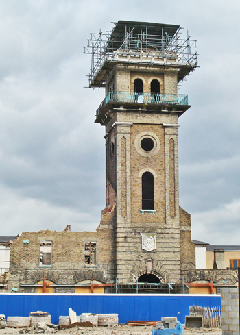
The Italianate central tower and a segment of one of the wings are all that remains of the workhouse buildings. The tower bears a masonry shield with the date '1865'.
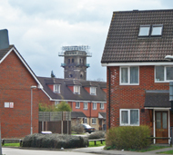
The tower, as seen in the distance from Attlee Close.

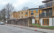
The Queens Resource Centre and Bensham Day Centre are on the left, behind the original Hospital gatepost (left). Part of the Hospital wall survives along Pawsons Road.
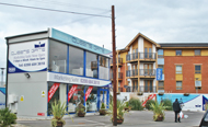
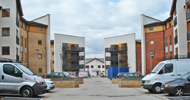
New housing on the site.

A hoarding advertising Queens Gate, the new development.
Update: October 2010
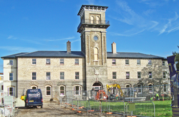
Work continues on the Kings Tower development.
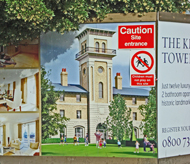
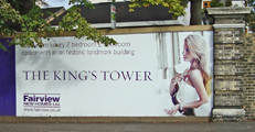
Advertisements for the King's Tower (the apostrophe has been restored!).
http://planning.croydon.gov.uk
www.croydon.gov.uk (1)
www.croydon.gov.uk (2)
www.croydononline.org (1)
www.croydononline.org (2)
www.derelictlondon.com
www.workhouses.org.uk
www.geograph.org.uk (1)
www.geograph.org.uk (2)
www.geograph.org.uk (3)
www.geograph.org.uk (4)
Return to home page